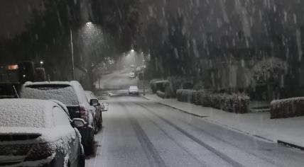
Temps set to get colder, falling as low as -6 degrees; Snow harder to predict
The chilly weather in the Netherlands is expected to continue for most of the next two weeks. Residents and tourists can expect several days of subzero temperatures, even during the daytime, starting on Sunday. Along with that is a chance of snow, but the likelihood has remained difficult to predict.
Temperatures should start to fall further on Friday, at which point the overnight temperature will remain below 0 degrees Celsius for at least a week, predicted the Dutch meteorological institute KNMI. Winter rain showers are also possible on Thursday and Friday, making commutes challenging in potentially icy conditions, however it could be dry over the weekend. Foggy conditions are also likely the next few mornings.
The thermometer will probably fall to its coldest point of -5 or -6 degrees during the early hours of Tuesday and Wednesday, with people in the east likely to face the coldest temperatures. In many places, the daytime temperature will rise at best to a high of 0 degrees, though it could be a couple of degrees warmer at the coast. The chance of the sun breaking through the cloud cover will remain small, but with better prospects on Saturday and Monday, the KNMI said.
But will it snow?
Some weather models have suggested the possibility of heavy snow in the Netherlands starting on Wednesday, but RTL Nieuws said the situation remains extremely variable. Forecasting winter weather one week out is more a sport for snow fans carried away by the hope of large drifts of white powder.
The news outlet’s meteorologists noted that an area of precipitation may develop from France and approach the Netherlands from the coast. Combined with very cold weather, that could translate to more snow.
However, the weather system could also pass the Netherlands by, with snow skipping the country and falling on the Alps instead.
And what about a White Christmas?
Some are also speculating about the possibility of a White Christmas, although this is quite rare for the Netherlands. The KNMI’s official definition is consistent snow cover both on Christmas Day and Boxing Day, which has only happened eight times since 1901.
The last official White Christmas was in 2010, when snow on the ground ranged between 5 and 20 centimeters almost everywhere, according to WeerOnline. In the southern portion of Limburg, snow even stacked up as high as 45 centimeters, though there were just a few centimeters of snow cover in De Bilt. The city in Utrecht is home to the KNMI, and considered the meteorological average for the Netherlands.
Christmas in the Netherlands often brings temperatures firmly above 0 degrees, even reaching a record 14 degrees in 2015. Currently, the KNMI is predicting the colder weather in the Netherlands will begin to get a bit warmer by 22 December.
